Hydrologic Data (Nestos River Catchment)
The spatially distributed hydrologic model MODSUR (“modélisation des transferts de surface”) is the surface modelling component of the coupled surface and groundwater MODCOU “modélisation couplée”) simulation model, which was developed at the Ecole Nationale Supérieure des Mines de Paris (Ledoux et al., 1989). The MODSUR model has successfully represented surface flow in many basins of varying scales, e.g. the Seine and Rhone basins in France, the Maritza basin in Bulgaria, and hydrogeological settings (Golaz et al., 2001; Habets et al., 1999a). It has also been coupled with atmospheric and agricultural models. The NEIGE component of the MODSUR-NEIGE model simulates the snow cover regime on the principle of “degree days” (Rango and Martinec, 2007) using an approach which distinguishes snow melting processes between forested and non-forested areas (Charbonneau et al, 1971).
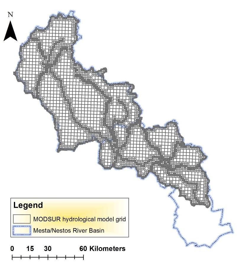
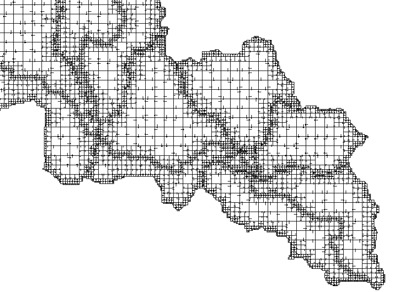
The model is based on a dense spatial grid made of variable size square cells. The surface domain is divided into grid cells of size a, 2a, 4a and 8a, the higher resolution being associated to the river grid boxes. Characteristics of the surface domain (run-off directions, altitude, soil, and land-use) are attached to each cell. The grid topology is based on the so-called 4 neighbors’ rule, i.e. each cell may only be connected to either a cell of the same dimension or a cell which is four times larger or even one which is four times smaller. The surface water is transferred through the run-off network or networks to the catchment outlet. The ensemble of connected cells builds a run-off network which gathers the flow down to the catchment outlet.
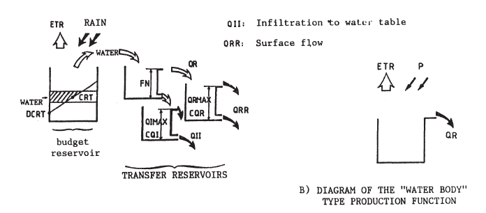
In MODSUR model the water budget is computed for each grid cell using the approach of “production functions”. A production function, associated with a soil type and a type of land cover, is composed of a system of four reservoirs dividing precipitation into infiltration, run-off, evapotranspiration and soil water storage.